
The depopulated village of Al-Mujaydal / District of Nazareth

Al-Mujaydal
About the depopulated village of Al-Mujaydal
- District
- Nazareth
- Date Al-Mujaydal was occupied
- 15 July 1948
- Population in 1948
- 2,204
- Military operation
- Operation Dekel
- Brigade that carried it out
- Golani Brigade
- Distance from the governorate centre
- 6 km southwest of Nazareth
- Elevation above sea level
- 230 m
- Cause of displacement
- Direct military assault by Israeli occupation forces, after which the village was completely emptied of its inhabitants and then razed to the ground
- Extent of destruction
- al-Mujaydil was mostly destroyed with the exception of the monastery and a partially destroyed church.
- Ethnic cleansing
- al-Mujaydil inhabitants were completely ethnically cleansed.
- Settlements built on the land of Al-Mujaydal before 1948
- Yif'at, established in 1926 on what were traditionally village lands, 2 km west of the site
- Settlements built on the built-up area of Al-Mujaydal after 1948
- Migdal ha-'Emeq, established in 1952 by Jewish immigrants from Iran on village land, less than 1 km southwest of the village site
- Refugees' migration routes
- About 1,200 refugees from al-Mujaydil had reportedly reached Nazareth by the end of July, 1948.
Hover a dot to read the village name, or click to open its card.
Borders of the depopulated village of Al-Mujaydal
al-Mujaydil: A Depopulated Palestinian Village in the Nazareth District
al-Mujaydil was a Palestinian village in the Nazareth District, located approximately 6 kilometres southwest of the city of Nazareth on the southern slopes of Wadi al-Mujaydil, at an average elevation of about 230 metres above sea level. Its population reached 1,900 in the 1944/1945 statistics. A Golani Brigade unit occupied the village on 14–15 July 1948 during the second stage of Operation Dekel. Its inhabitants were displaced and most of the village was subsequently destroyed during the Nakba and the occupation of Palestine in 1948.
- Subdistrict
- Nazareth
- Distance from district center
- 6 km southwest of Nazareth
- Average Elevation
- 230 m above sea level
- Population in 1931
- 1,241 – includes Arab al-Khurayfat, not the village alone
- Number of Houses in 1931
- 293 – includes Arab al-Khurayfat, not the village alone
- Population in 1944/1945
- 1,900 – 1,640 Muslims and 260 Christians
- Estimated Population in 1948
- About 2,204 – a later demographic estimate, not an official census
- Total Land Area in 1945
- 18,836 dunams
- Attack and Depopulation
- A crack unit of the Golani Brigade occupied the village on 14 or 15 July 1948, in the second stage of Operation Dekel, as the Israeli army closed in on Nazareth; the attack misled the defenders of Nazareth into believing that the city would be attacked from the south. The village was completely emptied of its inhabitants and then razed to the ground.
- Final Israeli Control
- 14–15 July 1948; the sources give 14 or 15 July without settling on either day
- Military Operation
- Operation Dekel (second stage)
- Military Unit
- A unit of the Golani Brigade, according to the History of the Haganah as cited by Khalidi; PalQuest, citing the History of the War of Independence, describes it as a crack unit
- Cause of Depopulation
- Direct military assault by Israeli occupation forces, after which the village was completely emptied of its inhabitants and then razed to the ground
- Settlements Documented on Village Lands
- Migdal ha-'Emeq, established in 1952 by Jewish immigrants from Iran on village land, less than 1 km southwest of the village site; Yif'at, established in 1926 on what were traditionally village lands, 2 km west of the site
Location
al-Mujaydil stood on the gently sloping southern sides of Wadi al-Mujaydil, along the main Nazareth–Haifa road.
The village lay approximately 6 kilometres southwest of Nazareth at an average elevation of about 230 metres above sea level.
Several springs flowed in the vicinity of the village, particularly to the southwest, and were used by the inhabitants for domestic and agricultural purposes.
al-Mujaydil Through History
In 1596, al-Mujaydil was a village in the Tiberias subdistrict of the Safad district, with an estimated population of approximately 22.
Its inhabitants paid taxes on wheat, barley, fruit trees, goats, and beehives.
In 1859, its population was estimated at approximately 800. By the late nineteenth century, al-Mujaydil was described as a flourishing village built of stone and mud, surrounded by cultivated lands and olive groves.
Traces of a Roman road were found near the village, indicating settlement and activity in the area during the Roman period. This evidence does not, however, establish that the modern Palestinian village itself dated in its entirety to Roman times.
Architecture
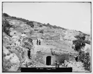
al-Mujaydil had an approximately triangular layout, and its houses were clustered closely together along the internal road network.
Homes were built of stone and mud, stone and cement, or concrete.
The built-up area amounted to approximately 34 dunams according to the 1944/1945 statistics.
The 1931 census recorded 293 houses in the population unit that included al-Mujaydil and Arab al-Khurayfat.
Population
The official 1922 Census of Palestine recorded 1,009 inhabitants in al-Mujaydil.
In the 1931 census, the population reached 1,241. PalQuest notes that both this population figure and the number of houses recorded in that census include Arab al-Khurayfat.
According to the 1944/1945 Village Statistics, al-Mujaydil had a population of 1,900, including 1,640 Muslims and 260 Christians. It was the third-largest village in the Nazareth subdistrict in terms of population.
The estimate of approximately 2,204 inhabitants for 1948 and 13,535 refugees and descendants in 1998, published by Palestine Remembered, are later estimates rather than official censuses of the Government of Palestine.
Population of al-Mujaydil
- 1596About 22Historical estimate based on Ottoman records
- 1859About 800Historical estimate
- 19221,009Official census
- 19311,241Official census; includes Arab al-Khurayfat
- 1944/19451,900Government of Palestine statistics: 1,640 Muslims and 260 Christians
- 1948About 2,204Later estimate
- 199813,535Estimate of refugees and their descendants
Number of Houses
The 1931 census recorded 293 houses in the population unit that included al-Mujaydil and Arab al-Khurayfat.
Education, Religion, and Local Administration
al-Mujaydil had two elementary schools, one for boys and one for girls.
The village also contained a Roman Catholic church and monastery, while Muslims constituted the majority of the population.
A local council administered the village's public affairs. The British Mandate's Survey of Palestine and the Palestine Gazette record expenditures and revenues associated with this council.
Land of al-Mujaydil
According to the 1944/1945 statistics, the lands of al-Mujaydil covered a total of 18,836 dunams.
Arab ownership amounted to 18,165 dunams, Jewish ownership to 485 dunams, while 186 dunams were classified as public land.
Land Ownership in al-Mujaydil in 1944/1945
- Arab ownership18,165 dunums96%
- Jewish ownership485 dunums3%
- Public land186 dunums<1%
Agriculture and Economic Life
Agriculture formed the backbone of al-Mujaydil's economy, with wheat and other cereals among its principal crops, alongside olives.
al-Mujaydil was the second-largest olive-producing village in the Nazareth subdistrict and had two mechanical olive presses.
According to the 1944/1945 statistics, cereal cultivation covered 15,474 dunams: 14,982 Arab-owned dunams, 437 Jewish-owned dunams, and 55 dunams of public land.
Irrigated and plantation land covered 1,719 dunams, including 1,685 Arab-owned dunams and 34 Jewish-owned dunams.
Approximately 1,600 dunams were planted with olive trees. This figure formed part of the cultivated and plantation land and should therefore not be added separately to the overall land-use totals.
Land Use in al-Mujaydil in 1944/1945, in Dunams
- Arab
- Jewish
- Public
- Cereals15,474 dunums
- Irrigated and plantation land1,719 dunums
- Built-up area34 dunums
- Uncultivable land1,609 dunums
Archaeology
Remains of a Roman road were found near al-Mujaydil.
These remains indicate settlement and human activity in the area during the Roman period, although they do not by themselves determine the date when the modern Palestinian village was founded.
The Nakba and the Occupation of al-Mujaydil
Operation Dekel
al-Mujaydil was occupied during the second stage of Operation Dekel, which began on 8 July 1948 and continued until 18 July. The operation resulted in the occupation of most of Lower Galilee, including Nazareth and numerous Palestinian villages.
Forces from the Seventh Brigade, the Golani Brigade, and the Carmeli Brigade participated in Operation Dekel as a whole.
The Force That Occupied al-Mujaydil
According to Walid Khalidi and PalQuest, drawing on material reproduced from the History of the Haganah, a special unit of the Golani Brigade occupied al-Mujaydil and the neighbouring village of Ma'lul.
The occupation took place on 14 or 15 July 1948 as Israeli forces closed in on Nazareth.
Palestine Remembered lists 15 July as the occupation date. It is therefore appropriate to use 15 July as the simplified date while noting in detailed historical discussion that the principal sources give 14–15 July.
The Tactical Role of the Attack
The attacks on al-Mujaydil and Ma'lul had a tactical role in the campaign against Nazareth, helping to create the impression among the city's defenders that the principal assault would come from the south.
The direct assault on Nazareth, however, subsequently came from the northwest, from the direction of Shafa 'Amr.
The principal Palestinian account of al-Mujaydil does not specifically document aerial bombardment of the village. Aerial bombing is therefore not presented here as an established feature of its occupation.
Occupation and Depopulation Chronology
- 8 July 1948
Beginning of the military operation
Operation Dekel began on the night of 8 July; during it most of Lower Galilee, including Nazareth, was occupied, with the Sheva' (Seventh), Golani and Carmeli Brigades taking part.
- 14–15 July 1948
Final occupation
A crack unit of the Golani Brigade occupied al-Mujaydil and neighbouring Ma'lul in the second stage of Operation Dekel as the Israeli army closed in on Nazareth; the sources give 14 or 15 July without settling on either day. According to the History of the Haganah as cited by Khalidi, the attack misled the defenders of Nazareth into believing that the city would be attacked from the south.
- July 1948
Depopulation of the village
Al-Mujaydil was completely emptied of its inhabitants, and about 1,200 refugees from the village had reportedly reached Nazareth by the end of July 1948, though it is not clear whether they remained there. The village was then razed to the ground, the sources giving no date for this.
- 1952
Settlement on village lands
Jewish immigrants from Iran established the settlement of Migdal ha-'Emeq on village land, less than 1 km southwest of the village site.
Displacement and Fate of the Village
al-Mujaydil was among the villages of Lower Galilee that were completely emptied of their Palestinian inhabitants following their occupation, after which most of the village was razed.
Sources report that approximately 1,200 refugees from al-Mujaydil had reached Nazareth by the end of July 1948, although it is unclear how many remained there permanently.
Some villagers became internally displaced Palestinians, while others were dispersed across refugee communities outside Palestine.
Israeli Settlements on the Lands of al-Mujaydil
Yif'at
The settlement of Yif'at was established in 1926 on land traditionally regarded as belonging to al-Mujaydil, approximately 2 kilometres west of the village site.
Migdal ha-'Emeq
Migdal ha-'Emeq was established in 1952 on al-Mujaydil's lands, less than 1 kilometre southwest of the former village site.
Walid Khalidi states that it was established by Jewish immigrants of Iranian origin.
- 1926Yif'at
Established on land traditionally regarded as belonging to al-Mujaydil, about 2 kilometres west of the site
- 1952Migdal ha-'Emeq
Established on al-Mujaydil's lands, less than 1 kilometre southwest of the village site
The Site of al-Mujaydil After the Nakba
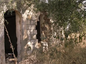
According to the field documentation relied upon by Walid Khalidi, most of the village site was covered by a pine forest used as a park.
The monastery and parts of the ruined church were among the principal surviving buildings, while remnants of destroyed houses and the walls of the cemetery remained visible.
Olive, fig, and pomegranate trees and cactus plants grew around the site, where several wells also remained.
This description reflects the condition of the site during the field documentation used by Walid Khalidi and should not necessarily be interpreted as a comprehensive survey updated to 2026.
Sources
- PalQuest – Interactive Encyclopedia of the Palestine Question: al-Mujaydil.
- PalQuest: Operation Dekel.
- PalQuest: al-Mujaydil.
- Palestine Remembered: al-Mujaydil, Nazareth District.
- Walid Khalidi, All That Remains: al-Mujaydil, as reproduced by Palestine Remembered.
- Walid Khalidi, All That Remains, entry on al-Mujaydil.
- Government of Palestine, censuses of 1922 and 1931.
- Government of Palestine, Department of Statistics, Village Statistics, 1945.
Photo gallery

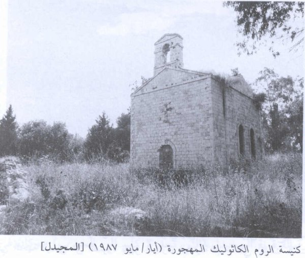


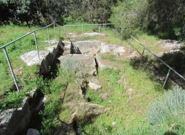

Photos from the village's people
Photos sent in by visitors and published after review.
Add a photo of this village
Log in to add photos of this village.
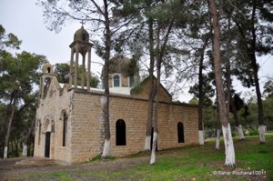
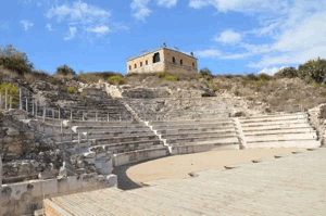
More from the archive
 Download Our Palestine App
The whole archive in the palm of your hand: depopulated villages, the Nakba, the massacres and Al-Aqsa — free, with no ads to erase the story.
Download Our Palestine App
The whole archive in the palm of your hand: depopulated villages, the Nakba, the massacres and Al-Aqsa — free, with no ads to erase the story.



Comments
No comments yet — be the first to write one.
Add your comment
Name and email are optional. Comments appear after review.