
The depopulated village of Kawfakha / District of Gaza
Subdistrict: Gaza Subdistrict
Estimated population of Kawfakha in 1948: Approximately 580 Palestinians
Date of occupation and depopulation: Night of 27–28 May 1948
Military unit: Negev Brigade of the Palmach
Israeli settlements established on Kawfakha’s lands before 1948: None
Israeli settlements established on Kawfakha’s lands after 1948: Nir Akiva, established in 1953 southwest of the village site
Kawfakha was a Palestinian village in the Gaza Subdistrict that was occupied and depopulated during the Nakba. It was located in the northern Negev, approximately 19 kilometres east of Gaza, at an average elevation of about 150 metres above sea level.
The village stood on an undulating stretch of sandy terrain. A network of secondary roads connected it with the main roads running between Gaza and Julis, which were broadly parallel to the coastal highway.
Kawfakha was surrounded by al-Muharraqa to the southwest, Huj to the northwest, al-Jammama to the northeast and lands associated with the Bedouin communities of Bir al-Saba to the east and southeast.
- Kawfakha was established in the late nineteenth century by residents of Gaza who settled there to cultivate the surrounding land.
- A regionally prominent mosque stood at the centre of the village. It was constructed during the reign of Ottoman Sultan Abd al-Hamid II, between 1876 and 1909.
- The village had an elementary school and several small shops.
- All the recorded residents of Kawfakha were Palestinian Muslims.
Boundaries and Neighbouring Villages
- Northwest: Huj.
- West: Gaza.
- Southwest: al-Muharraqa.
- South, southeast and east: Lands inhabited or used by Palestinian Bedouin communities associated with Bir al-Saba.
- Northeast: al-Jammama.
Location and Architectural Character
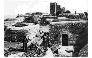
Kawfakha’s houses extended along a northwest–southeast axis in a broadly rectangular pattern. The village stood beside the southern bank of Wadi Abu Shunnar, a tributary of Wadi Hawdaj.
The mosque occupied a central position in the village. Kawfakha also contained an elementary school, several shops and two wells that supplied water for domestic use.
Land of Kawfakha
Kawfakha had a total land area of 8,569 dunams. According to the British Mandate’s 1945 Village Statistics, 87 dunams were registered under Palestinian private ownership and 8,482 dunams were classified as public land. No land was recorded under Jewish ownership.
The unusually large public-land classification must be interpreted within the British Mandate’s administrative and land-registration system. It does not establish that the land was uninhabited or unused. The villagers cultivated much of this land, particularly for cereal production.
The British Mandate census recorded 203 residents in 1922. By 1945, Kawfakha had 500 residents, while its population immediately before the Nakba has been retrospectively estimated at approximately 580.
Land Ownership in Kawfakha, 1944/45
| Ownership category | Area (dunams)* |
|---|---|
| Palestinian private ownership | 87 |
| Jewish ownership | 0 |
| Public land | 8,482 |
| Total | 8,569 |
* One dunam equals approximately 1,000 square metres.
Land Use in Kawfakha, 1944/45
| Land-use category | Palestinian private ownership (dunams)* | Jewish ownership (dunams)* | Public land (dunams)* | Total (dunams)* |
|---|---|---|---|---|
| Irrigated land and orchards | 87 | 0 | 0 | 87 |
| Cereal cultivation | 0 | 0 | 7,768 | 7,768 |
| Built-up area | 0 | 0 | 31 | 31 |
| Cultivable land | 87 | 0 | 7,768 | 7,855 |
| Uncultivated land | 0 | 0 | 683 | 683 |
* One dunam equals approximately 1,000 square metres.
Economic Life in Kawfakha
Most residents of Kawfakha worked in agriculture. Farming depended on both rainfall and irrigation. Water was obtained from wells, cisterns and reservoirs in which winter rainwater was collected.
The village lands were known locally for their fertile reddish soil. Fruit trees were planted north of the village, including apricot, olive, almond, grape and fig trees. Cereals were cultivated on the other sides of the village.
In 1944/45, 87 dunams were irrigated or used for orchards, while 7,768 dunams classified as public land were allocated to cereal cultivation. The public classification refers to the official land category and does not mean that the land was not cultivated by the Palestinian villagers.
Historical Population of Kawfakha
| Year | Recorded or estimated population | Notes |
|---|---|---|
| 1922 | 203 | Recorded in the British Mandate census; all residents were Muslims. |
| 1931 | 317 | Recorded in the British Mandate census; the population lived in 56 houses. |
| 1945 | 500 | Recorded in the British Mandate’s Village Statistics. |
| 1948 | Approximately 580 | Projected estimate rather than a new official census. |
| 1998 | Approximately 3,562 refugees and descendants | A retrospective estimate published by Palestine Remembered. |
Number of Houses in Kawfakha
| Year | Number of houses | Status of figure |
|---|---|---|
| 1931 | 56 | Recorded in the British Mandate census. |
| 1948 | Approximately 102 | Later estimate; no comparable official village housing census was conducted in 1948. |
Archaeological Remains
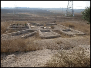
Kawfakha contained the remains of Khirbat al-Kawfakha. Recorded archaeological features included cisterns, fragments of marble columns, a Corinthian capital, mosaic pavements and pottery sherds.
These remains indicate that the location was inhabited or used during earlier historical periods, before the village was re-established by residents from Gaza in the late nineteenth century.
Occupation and Depopulation of Kawfakha
Local Palestinian accounts describe several confrontations between Kawfakha’s residents and Zionist forces during 1948. The villagers possessed only a limited number of rifles and reportedly cooperated with residents of neighbouring al-Muharraqa in resisting attacks. These details form part of the village’s locally preserved history, but a complete independent military record of every confrontation has not been identified.
According to the account compiled by the Palestinian academic resource PalQuest, units of the Palmach’s Negev Brigade raided Kawfakha during the night of 27–28 May 1948. The neighbouring Palestinian village of al-Muharraqa was attacked at approximately the same time.
A contemporary report published by The New York Times on 30 May stated that Kawfakha and al-Muharraqa had been captured. The villagers were expelled or driven south towards the Gaza area.
PalQuest reports that the residents had previously sought an arrangement that would allow them to remain in their village, but their requests were rejected. The occupation therefore resulted in the forced depopulation of Kawfakha rather than the continued residence of its Palestinian population.
Local accounts further state that crops and threshing floors containing wheat and barley were burned during the attacks. Because detailed accounts of the fighting differ and have not all been independently documented, these elements should be presented as locally preserved testimony rather than as a complete military chronology.
Israeli Settlements on the Lands of Kawfakha
Nir Akiva was established in 1953 on Kawfakha’s lands, southwest of the former village site. No Israeli settlement is recorded as having been established on the village’s land before its occupation and depopulation in 1948.
Kawfakha Today
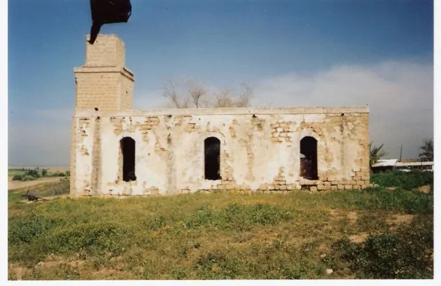
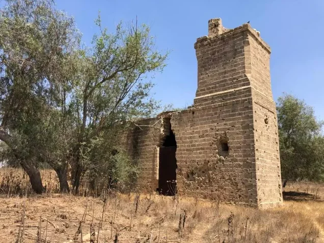
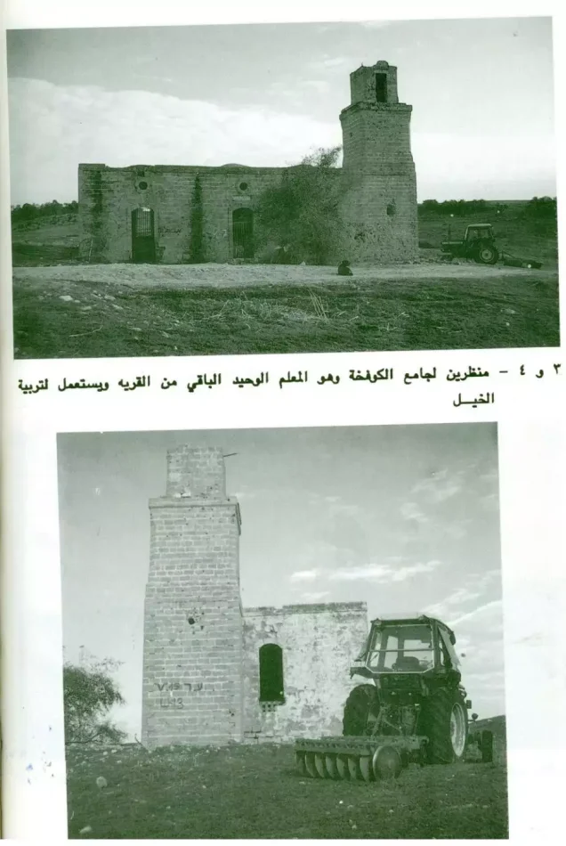
The mosque is the principal surviving building from Kawfakha. It is a stone structure with arched entrances and windows on all sides. Its roof is surmounted by three shallow domes, and a square minaret stands at its northwestern corner.
Walid Khalidi’s field survey reported that the mosque was being used as a storehouse for animal fodder and as a stable for horses. Documentation published by the Palestinian BADIL Resource Center has also recorded the mosque’s use as a stable.
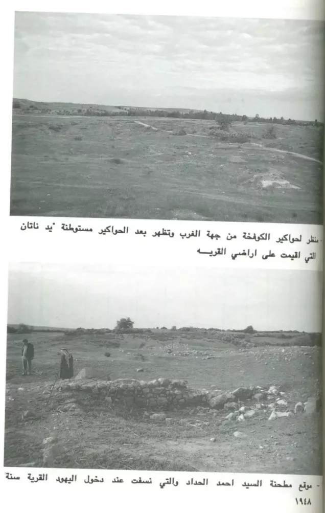
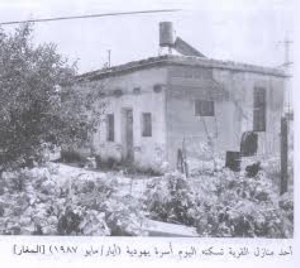
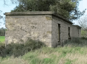
The village site contains piles of rubble and is overgrown with cactus and other plants characteristic of the region. It has been fenced and used as grazing land. A citrus orchard lies to the west, while cereals have been cultivated on part of the surrounding Palestinian village lands.
Sources
- Interactive Encyclopedia of the Palestine Question (PalQuest), “Kawfakha”.
- PalQuest, “Kawfakha I,” photographic documentation of the village mosque.
- Palestine Remembered, “Kawfakha—Gaza”.
- Our Palestine, “The Depopulated Village of Kawfakha”.
- BADIL Resource Center for Palestinian Residency and Refugee Rights, documentation of Palestinian religious sites.
- Walid Khalidi, ed., All That Remains: The Palestinian Villages Occupied and Depopulated by Israel in 1948, Institute for Palestine Studies, 1992, pp. 119–120.
- Government of Palestine, Census of Palestine, 1922.
- Government of Palestine, Census of Palestine, 1931.
- Government of Palestine, Department of Statistics, Village Statistics, April 1945.
- The New York Times, contemporary report published on 30 May 1948.
Photo gallery


Photos from the village's people
Photos sent in by visitors and published after review.
Add a photo of this village
Log in to add photos of this village.
Other villages from Gaza
 Download Our Palestine App
The whole archive in the palm of your hand: depopulated villages, the Nakba, the massacres and Al-Aqsa — free, with no ads to erase the story.
Download Our Palestine App
The whole archive in the palm of your hand: depopulated villages, the Nakba, the massacres and Al-Aqsa — free, with no ads to erase the story.



Comments
No comments yet — be the first to write one.
Add your comment
Name and email are optional. Comments appear after review.