
The depopulated village of Iraq Suwaydan / District of Gaza
Subdistrict: Gaza Subdistrict
Estimated population of Iraq Suwaydan in 1948: 766
Date of occupation and depopulation: 10 November 1948
Israeli settlements established on Iraq Suwaydan’s land before 1948: None
Israeli settlements established on or near Iraq Suwaydan’s land after 1948: Yad Natan and Otzem were established on village land; Sde Yoav was established west of the village, close to its land.
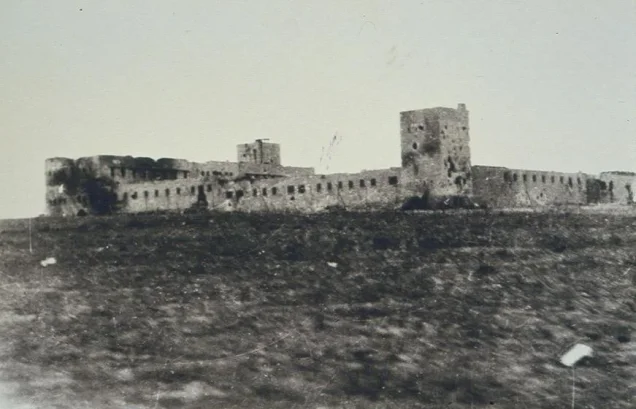
Iraq Suwaydan was a Palestinian village in the Gaza Subdistrict, located approximately 27 kilometres northeast of Gaza. It stood near the road linking al-Majdal with the interior of Palestine. Israeli forces occupied the village on 10 November 1948 during the Nakba, following the capture of its strategically important police fort on the previous day. Its Palestinian inhabitants were displaced, and the village was subsequently destroyed, with the exception of the British-built police station.
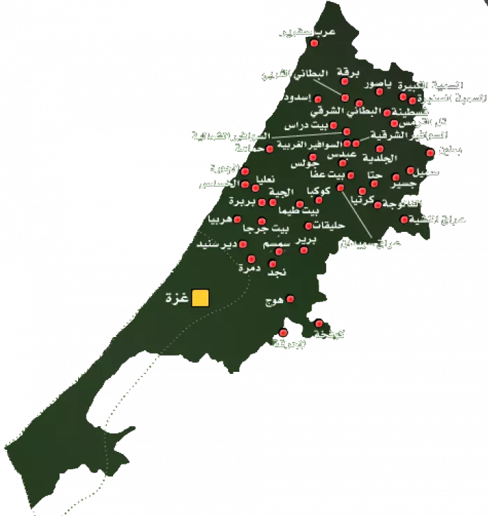
Location of Iraq Suwaydan
- Iraq Suwaydan was located approximately 27 kilometres northeast of Gaza.
- The village stood on a small plateau with reddish-brown soil on the coastal plain. The main al-Faluja–al-Majdal road passed along its southern edge.
- During the British Mandate, the British authorities constructed a fortified police station west of the village beside the same road.
- The first element of the village’s name, “Iraq,” denotes a small hill or elevated feature in Arabic and appears to refer to the village’s topography. The origin of “Suwaydan,” a proper name, is uncertain.
- The lands of Iraq Suwaydan bordered those of Karatiyya, al-Faluja, Kawkaba, and Bayt Affa.
Population of Iraq Suwaydan
The population of Iraq Suwaydan was recorded as 349 in the 1922 British Mandate census. It increased to 440 in the 1931 census and reached 660 in the official 1945 village statistics. The inhabitants were Palestinian Muslims. A demographic projection places the village’s population at approximately 766 in 1948; because this is an estimate rather than a census count, some sources round the figure to about 770.
Economic Life in Iraq Suwaydan
Two wells supplied the village with water for domestic use, while its agriculture depended primarily on rainfall. Cereal cultivation formed the main basis of the local agricultural economy, although smaller areas were planted with fruit trees, including almond trees, as well as grapevines. In 1944–1945, 7,329 dunams were devoted to cereal cultivation, while 9 dunams were classified as irrigated land or orchards.
Land Ownership in Iraq Suwaydan
| Ownership category | Land area (dunams)* |
|---|---|
| Palestinian ownership | 7,380 |
| Jewish ownership | 0 |
| Public land | 149 |
| Total | 7,529 |
* One dunam equals approximately 1,000 square metres.
Land Use in Iraq Suwaydan
| Land-use category | Area (dunams)* |
|---|---|
| Irrigated land and orchards | 9 |
| Cereal cultivation | 7,329 |
| Built-up area | 35 |
| Cultivable land | 7,338 |
| Uncultivated land | 156 |
* One dunam equals approximately 1,000 square metres.
Population Records for Iraq Suwaydan
| Year | Population* |
|---|---|
| 1922 | 349 |
| 1931 | 440 |
| 1945 | 660 |
| 1948 | 766 |
| Estimated number of refugees in 1998 | 4,702 |
* The figures for 1948 and 1998 are demographic estimates rather than contemporaneous census counts. Estimates vary between sources.
Number of Houses in Iraq Suwaydan
| Year | Number of houses* |
|---|---|
| 1931 | 81 |
| 1948 | 134 |
* The 1931 figure is an official census count; the 1948 figure is an estimate.
Education in Iraq Suwaydan
The inhabitants established a private elementary school in 1942. After 1947, the school also served pupils from the neighbouring villages of Ibdis and Bayt Affa. Enrollment from the three villages totalled 104 pupils in the mid-1940s.
Archaeological Sites in Iraq Suwaydan
The area contained burial places, rock-cut caves, and remains of mosaic flooring. Two archaeological sites, Khirbat al-Shaykh Muhammad and Khirbat al-Shaykh Abdallah, were located west of the village along the main road. Surface evidence indicates that both sites were extensively occupied during the Byzantine period.
Occupation and Depopulation of Iraq Suwaydan
On the eve of the British withdrawal from Palestine on 15 May 1948, the British authorities transferred control of the village police station to the local population. Egyptian forces subsequently entered Palestine, and their First Battalion was ordered to take up positions at Iraq Suwaydan. The fortified police station was strategically significant because it controlled the road between al-Majdal and Bayt Jibrin, as well as the inland route leading towards the Naqab.
Following the end of the first truce, Israeli forces renewed their attempts to seize the area. Units of the Negev Brigade were assigned to capture the police station, while the Fourth Battalion of the Givati Brigade was ordered to occupy the village. During the night of 8–9 July 1948, Givati forces briefly entered Iraq Suwaydan but withdrew almost immediately after the Negev Brigade failed to capture the police station. Without control of the fortified position, the Israeli forces regarded the village as indefensible.
The police fort remained under Egyptian control despite repeated Israeli assaults. It was finally captured on 9 November 1948 in the eighth assault, known as Operation Shmone, which followed Operation Yoav. The attack was led by the Ninth Battalion of Israel’s Eighth Armored Brigade, with assistance from Givati forces. It began with an intensive artillery bombardment and included an infantry and armoured assault; United Nations truce observers also reported the use of B-17 aircraft.
On 10 November, an Israeli military communiqué announced that Egyptian troops had withdrawn from Iraq Suwaydan and neighbouring Bayt Affa and that Israeli forces had occupied both villages. The available contemporary account did not establish whether any Palestinian inhabitants remained in Iraq Suwaydan at that moment. Accordingly, 10 November 1948 is generally recorded as the date of the village’s final occupation and depopulation, while 9 November marks the capture of the police fort.
Israeli Settlements Established on or near the Land of Iraq Suwaydan
Yad Natan, an Israeli agricultural settlement, was established east of the village site on Iraq Suwaydan’s land in 1953. Otzem was established southeast of the site on village land in 1955. Sde Yoav, initially known as Bayt Yoav, was established west of the village in 1956, close to its land. The surrounding agricultural land was subsequently cultivated by Israeli farmers.
Iraq Suwaydan Today
- The village was destroyed after its Palestinian population had been displaced. The British-built police station was preserved and renamed Metzudat Yoav, or Yoav Fortress.
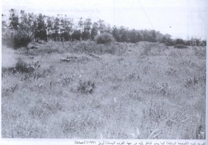
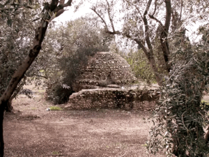
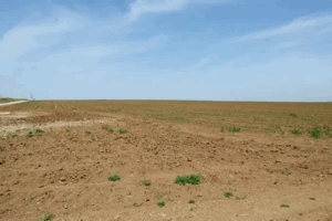
- The remains of village houses lie within a eucalyptus grove covering the centre of the site. Cactus plants and the remains of a pool are still visible. Two former village roads can also be identified: one passes through the site, while the other crosses the village lands.
Sources
- Interactive Encyclopedia of the Palestine Question – Iraq Suwaydan
- Palestine Open Maps – Iraq Suwaydan
- Palestine Remembered – Iraq Suwaydan
- Walid Khalidi, All That Remains: The Palestinian Villages Occupied and Depopulated by Israel in 1948, Institute for Palestine Studies, 1992, pp. 108–109.
- Government of Palestine, Census of Palestine, 1931: Population of Villages, Towns and Administrative Areas.
- Government of Palestine, Village Statistics, April 1945.
Photo gallery


Photos from the village's people
Photos sent in by visitors and published after review.
Add a photo of this village
Log in to add photos of this village.
Other villages from Gaza
 Download Our Palestine App
The whole archive in the palm of your hand: depopulated villages, the Nakba, the massacres and Al-Aqsa — free, with no ads to erase the story.
Download Our Palestine App
The whole archive in the palm of your hand: depopulated villages, the Nakba, the massacres and Al-Aqsa — free, with no ads to erase the story.



Comments
No comments yet — be the first to write one.
Add your comment
Name and email are optional. Comments appear after review.