
The depopulated village of Bayt Daras / District of Gaza
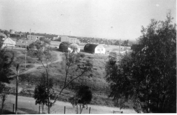
Subdistrict: Gaza
Estimated population of Bayt Daras in 1948: 3,190
Date of occupation and depopulation: 10 May 1948 according to Walid Khalidi and Benny Morris; Egyptian accounts indicate that control remained contested into June 1948
Military unit: Giv'ati Brigade
Military operation: Operation Barak
Israeli settlements established on Bayt Daras land before 1948: None
Israeli settlements established on the village site after 1948: Giv'ati
Israeli settlements established elsewhere on village land after 1948: Azriqam and Emunim; the Zemorot farm was later established at Khirbat 'Awda
About Bayt Daras
Bayt Daras was a depopulated Palestinian village situated approximately 32 kilometres northeast of Gaza and about 50 metres above sea level. Its lands covered 16,357 dunams, including 832 dunams devoted to citrus fruit and bananas in 1944/45.
The village stood on generally level terrain that rose towards the west and southwest to form a hill. A network of unpaved roads connected Bayt Daras with neighbouring Palestinian villages, particularly Isdud on the coastal highway and Julis, helping it develop into an important rural centre. The village contained two mosques and an elementary school.
Bayt Daras possessed a long historical legacy. A Crusader castle stood on the hill overlooking the village. During the Mamluk period, Bayt Daras served as a postal station on the route between Gaza and Damascus, and a khan, or caravansary, was constructed there.
Boundaries of Bayt Daras
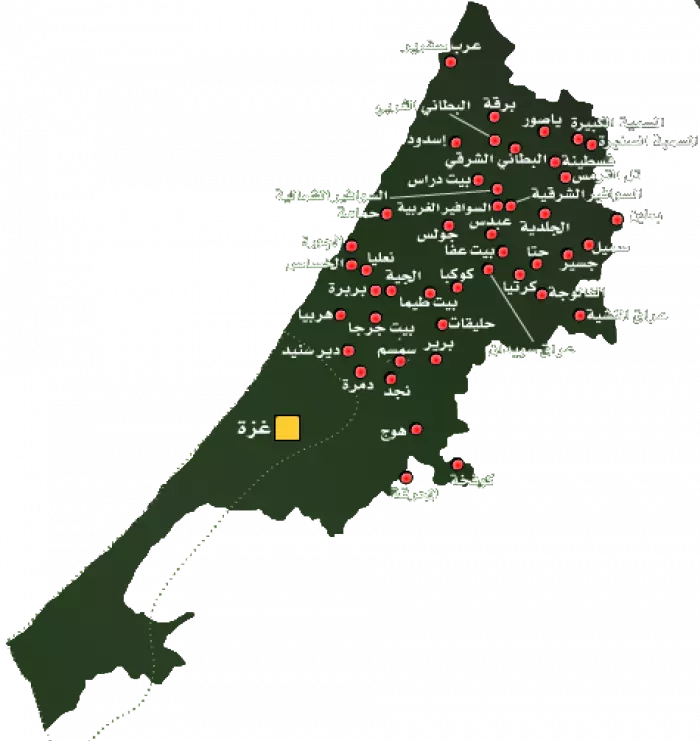
Bayt Daras was surrounded by the following Palestinian villages and towns:
Northwest and west: Isdud.
Southwest: Julis.
South: 'Ibdis.
Southeast: al-Sawafir al-Shamaliyya.
Northeast: al-Batani al-Gharbi.
Architecture and Historical Heritage in Bayt Daras
In the late nineteenth century, Bayt Daras was surrounded by gardens and olive groves, with a pond located to its north. Many of its houses were built of adobe brick. In the later British Mandate period, the village expanded southwestward along the road leading to Julis.
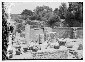
The village also contained an archaeological site with stone foundations and vaulted rooms. A Crusader castle had been built on the hill overlooking the village. During Mamluk rule, Bayt Daras became a postal station on the Gaza–Damascus route, and historical accounts record the construction of a khan there.
Public Facilities in Bayt Daras
Bayt Daras had two mosques and an elementary school established in 1921. By the mid-1940s, the school enrolled 234 pupils. The village also had a mechanically powered grain mill that served the agricultural community.
Economic Life in Bayt Daras
The village’s level terrain and abundant water made most of its lands suitable for cultivation. Agriculture was the principal source of livelihood, and much of it was rainfed. The inhabitants cultivated cereals, vegetables, fruit, and particularly citrus crops.
In 1944/45, 832 dunams were devoted to citrus fruit and bananas, 472 dunams were irrigated or used for orchards, and 14,438 dunams were used for cereal cultivation. The cereal figure comprised 14,436 dunams of Palestinian-owned land and 2 dunams of public land.
The inhabitants also raised cattle, horses, camels, sheep, goats, and poultry. Some villagers worked in handicrafts and commerce, while the mechanical mill processed locally produced grain.
Land Ownership in Bayt Daras
| Ownership category | Area (dunams)* |
|---|---|
| Palestinian ownership | 15,896 |
| Jewish ownership | 0 |
| Public land | 461 |
| Total | 16,357 |
* One dunam equals approximately 1,000 square metres.
Land Use in Bayt Daras in 1944/45
| Land-use category | Palestinian land (dunams)* | Public land (dunams)* | Total (dunams)* |
|---|---|---|---|
| Citrus and banana cultivation | 832 | 0 | 832 |
| Irrigated land and orchards | 472 | 0 | 472 |
| Cereal cultivation | 14,436 | 2 | 14,438 |
| Built-up area | 88 | 0 | 88 |
| Cultivable land | 15,740 | 2 | 15,742 |
| Uncultivated land | 68 | 459 | 527 |
* One dunam equals approximately 1,000 square metres.
Population of Bayt Daras
Bayt Daras had 1,670 inhabitants in the 1922 British Mandate census. Its population increased to 1,804 in 1931, when 401 inhabited houses were recorded. The inhabitants counted in both censuses were Muslims.
The official 1945 village statistics estimated the population at 2,750, all Palestinian Muslims. A later demographic projection placed the population at approximately 3,190 in 1948.
Historical Population of Bayt Daras
| Year | Population | Type of figure |
|---|---|---|
| 1596 | 319 | Estimate based on Ottoman fiscal records |
| 1922 | 1,670 | British Mandate census |
| 1931 | 1,804 | British Mandate census |
| 1945 | 2,750 | Official population estimate |
| 1948 | 3,190 | Demographic projection |
| Estimated refugee population in 1998 | 19,590 | Later demographic estimate |
The 1948 and 1998 figures are demographic estimates rather than contemporary census counts.
Number of Houses in Bayt Daras
| Year | Number of houses |
|---|---|
| 1931 | 401 |
| 1948 | 709 (estimate) |
Occupation and Depopulation of Bayt Daras
Bayt Daras was subjected to several attacks during Israel’s occupation of Palestine—the Nakba. According to the Palestinian and Arab account cited by Walid Khalidi, an indiscriminate mortar bombardment on 27–28 March 1948 killed nine villagers, described as non-combatants, and started fires that destroyed crops and livestock. A brief battle followed another attack on 29 March.
According to Benny Morris, the Giv'ati Brigade subjected Bayt Daras to mortar fire before launching a ground assault and occupying the village on 10 May 1948. The attack occurred at the beginning of Operation Barak, which formed part of Plan Dalet. Morris states that the inhabitants fled during the assault and that houses were subsequently demolished as Giv'ati forces sought to clear their southern front before the end of the British Mandate.
Egyptian accounts provide a different chronology. They indicate that Bayt Daras was not securely occupied until after the first truce began on 11 June 1948. Gamal Abdel Nasser, then a staff officer in the Egyptian Sixth Battalion, later recalled that Israeli forces consolidated their position in the area during the truce.
According to Abdel Nasser’s account, Sudanese forces recaptured Bayt Daras during an attempted Arab operation. A signalling error, however, led Egyptian artillery to bombard the position after a red failure signal was fired instead of the planned green success signal, forcing the Sudanese force to withdraw.
These accounts indicate that military control of Bayt Daras remained contested after the initial Giv'ati assault. Accordingly, 10 May is best presented as the date of the principal occupation and depopulation assault documented by Khalidi and Morris, while later Egyptian accounts demonstrate that fighting over the village continued into June and July 1948.
Palestinian accounts describe killings during the successive attacks and the inhabitants’ flight from the village. Beyond the nine non-combatants reported killed in the March bombardment, estimates of the total number of victims vary between sources. The available evidence does not support presenting a single final casualty figure without qualification.
Israeli Settlements on the Lands of Bayt Daras
Three Israeli settlements were established on village land in 1950:
- Azriqam: Established on land belonging to Bayt Daras.
- Emunim: Established on land belonging to Bayt Daras.
- Giv'ati: Established at or immediately adjoining the former village site.
Later in the 1950s, a farm known as Zemorot was established at Khirbat 'Awda, which also formed part of Bayt Daras land. Zemorot should not be treated as an earlier name for Giv'ati; the principal academic source identifies them as separate establishments.
Bayt Daras Today
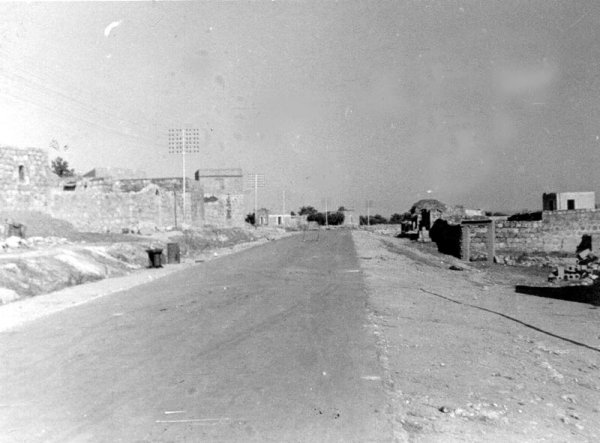
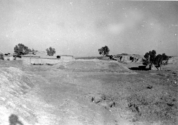
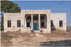
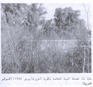
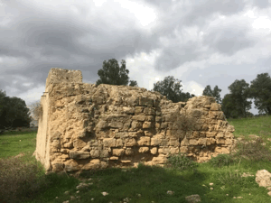
The foundations of one house and scattered rubble are the principal documented remains of the village buildings. Wild vegetation, cactus plants, and eucalyptus trees cover parts of the site. At least one of the village’s former streets remains identifiable, while the surrounding lands are cultivated by the inhabitants of the Israeli settlements established there.
Sources
- Interactive Encyclopedia of the Palestine Question: Bayt Daras.
- Walid Khalidi, ed., All That Remains: The Palestinian Villages Occupied and Depopulated by Israel in 1948, Institute for Palestine Studies.
- Palestine Remembered: Bayt Daras, Gaza Subdistrict.
- Village Statistics, April 1945, Government of Palestine.
- Gamal Abdel Nasser, “Memoirs of the First Palestine War,” published in the Journal of Palestine Studies and cited in Walid Khalidi’s account of Bayt Daras.
- Benny Morris, The Birth of the Palestinian Refugee Problem, 1947–1949, as cited by the Interactive Encyclopedia of the Palestine Question.
Photo gallery

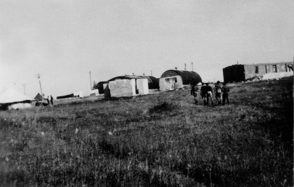
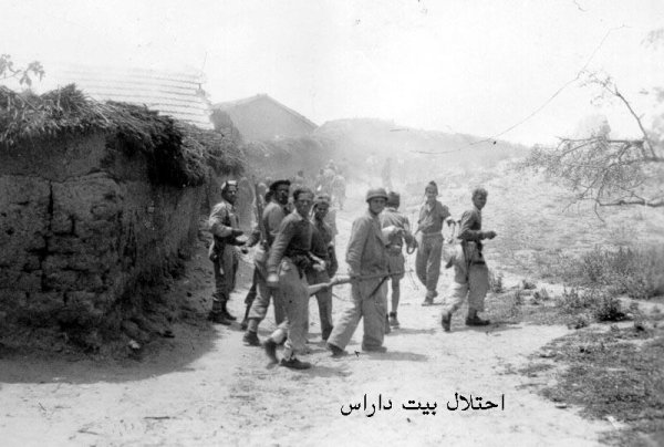

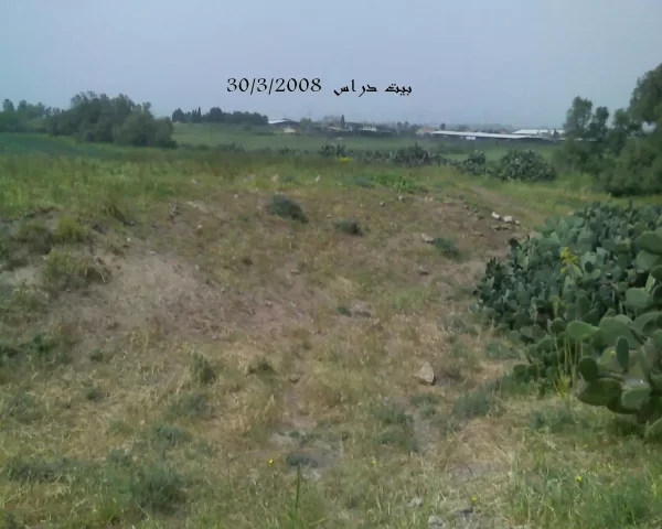
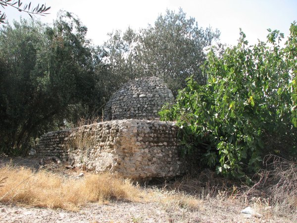
Photos from the village's people
Photos sent in by visitors and published after review.
Add a photo of this village
Log in to add photos of this village.
Other villages from Gaza
 Download Our Palestine App
The whole archive in the palm of your hand: depopulated villages, the Nakba, the massacres and Al-Aqsa — free, with no ads to erase the story.
Download Our Palestine App
The whole archive in the palm of your hand: depopulated villages, the Nakba, the massacres and Al-Aqsa — free, with no ads to erase the story.



Comments
No comments yet — be the first to write one.
Add your comment
Name and email are optional. Comments appear after review.