
The depopulated village of Yasur / District of Gaza
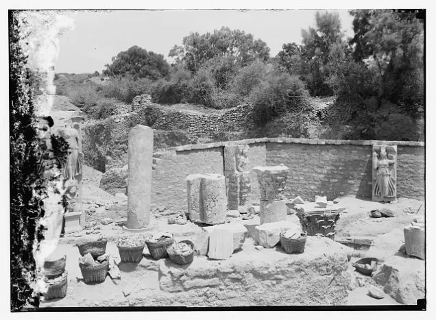
Subdistrict: Gaza
Estimated population of Yasur in 1948: approximately 1,241
Date of occupation and depopulation: Night of 10–11 June 1948
Military operation: The attack followed Operation Barak rather than forming part of its principal May 1948 phase.
Military unit: First Battalion of the Giv‘ati Brigade
Israeli settlements established on Yasur’s lands before 1948: None. Hatzor Ashdod was founded in 1937 on land traditionally belonging to al-Batani al-Gharbi, more than 2 kilometres northwest of Yasur.
Israeli settlements established on Yasur’s lands after 1948: Talmey Yechi’el and Bene ‘Ayish
Yasur was a depopulated Palestinian village in the northern part of the Gaza Subdistrict. It was occupied by Israeli forces and its inhabitants were displaced during the 1948 Nakba. Its population stood at 1,070 in 1945 and was later estimated at approximately 1,241 in 1948. The estimated number of refugees originating from the village and their descendants reached 7,622 in 1998.
Location of Yasur
The village was located approximately 40 kilometres northeast of Gaza.
Yasur stood on a plateau in the coastal plain. Secondary roads linked it to a highway leading southwest to al-Majdal and another highway leading northeast to al-Ramla.
Wadi al-Zurayq passed south of the village and fed Wadi al-Gharbi, one of the tributaries connected through Wadi al-‘Asal to Wadi Sukrayr.
Boundaries of Yasur
Yasur lay among the following Palestinian villages:
- North: Qatra.
- Northwest: Bashshit.
- West: Barqa.
- Southwest: al-Batani al-Sharqi.
- Southeast: Qastina.
- East: al-Masmiyya al-Kabira.
- Northeast: al-Mukhayzin.
Education in Yasur
An elementary school opened in Yasur in 1923. Its enrolment reached 132 pupils by the mid-1940s. A mosque, several shops, and the school were located in the centre of the village.
Economic Life in Yasur
- The villagers obtained water for domestic use from wells. Agriculture formed the backbone of the economy, and the principal crops included cereals, citrus fruit, olives, and vegetables. In 1944/45, 636 dunams under Palestinian ownership were devoted to citrus and bananas, 12,173 dunams to cereal cultivation, and 180 dunams were irrigated or used for orchards.
- Cereals were cultivated principally through rainfed agriculture, whereas citrus fruit and vegetables were irrigated with water drawn from wells approximately 25–40 metres deep.
- The village also contained several shops serving its inhabitants.
Land Ownership in Yasur, 1944/45
| Ownership category | Area in dunams |
|---|---|
| Palestinian ownership | 13,102 |
| Jewish ownership | 2,871 |
| Public land | 417 |
| Total | 16,390 |
* One dunam equals approximately 1,000 square metres.
Land Use in Yasur, 1944/45
| Land-use category | Palestinian ownership (dunams) | Jewish ownership (dunams) | Public land (dunams) | Total (dunams) |
|---|---|---|---|---|
| Citrus and banana cultivation | 636 | 741 | 0 | 1,377 |
| Irrigated land and orchards | 180 | 13 | 0 | 193 |
| Cereal cultivation | 12,173 | 2,117 | 0 | 14,290 |
| Built-up area | 35 | 0 | 0 | 35 |
| Cultivable land | 12,989 | 2,871 | 0 | 15,860 |
| Uncultivated land, excluding the built-up area | 78 | 0 | 417 | 495 |
* One dunam equals approximately 1,000 square metres. The original table incorrectly assigned all 495 dunams of uncultivated land to Palestinian ownership; British Mandate statistics classified 417 dunams of this area as public land.
Population of Yasur
| Year | Population | Notes |
|---|---|---|
| 1596 | Approximately 303 | Estimate derived from Ottoman tax records |
| 1922 | 456 | All recorded as Muslims |
| 1931 | 654 | 648 Muslims, five Christians, and one Jewish resident |
| 1945 | 1,070 | All recorded as Palestinian Muslims |
| 1948 | Approximately 1,241 | Later demographic estimate, sometimes rounded to 1,240 |
| Estimated registered refugee population, 1998 | 7,622 | Later estimate including descendants |
* The 1948 and 1998 figures are demographic estimates rather than contemporary official censuses.
Number of Houses in Yasur
| Year | Number of houses | Statistical status |
|---|---|---|
| 1931 | 129 | Occupied houses recorded by the census |
| 1948 | Approximately 244 | Later estimate |
Occupation and Depopulation of Yasur
According to The History of the War of Independence, Yasur was occupied immediately before the first truce took effect, during the night of 10–11 June 1948. The assault was conducted by the First Battalion of the Giv‘ati Brigade as part of a series of operations planned for the final night before the truce.
The attack followed Operation Barak, which had been launched during the first half of May to occupy Palestinian villages in the southern and central coastal plain. It is therefore more accurate to describe the assault on Yasur as occurring in the aftermath of Operation Barak rather than simply stating that the village fell during the operation itself.
Some secondary sources date the military assault to 9 June, while the account cited by PalQuest places the village’s occupation on the night of 10–11 June. Estimates vary between sources; 11 June is retained here as the best-documented date for the completion of the occupation and depopulation.
A Haganah account stated that the village’s name was subsequently changed to Hatzor. Walid Khalidi’s account identifies this as a probable reference to Hatzor Ashdod. That settlement, however, had been founded in 1937 on land traditionally belonging to the Palestinian village of al-Batani al-Gharbi, more than 2 kilometres northwest of Yasur. It should not therefore be classified as a settlement established on Yasur’s lands.
Israeli Settlements on Yasur’s Lands
- Talmey Yechi’el was established on Yasur’s lands in 1949.
- Bene ‘Ayish was established on Yasur’s lands in 1958.
- Hatzor Ashdod was established in 1937 on land traditionally belonging to al-Batani al-Gharbi and not on the registered lands of Yasur.
The People of Yasur Today
The inhabitants of Yasur were displaced during the Nakba. Historical documentation records that some displaced villagers were living in tents in what became al-Maghazi refugee camp in the Gaza Strip by early 1949. Families and descendants from Yasur subsequently lived in Gaza, Jordan, and other places of exile.
Community accounts report that village descendants established the Yasur Charitable Association in Amman in 2004. This organizational detail is based on community documentation and is not included in the principal British Mandate or village-history sources.
Yasur Today
According to the survey published in Walid Khalidi’s All That Remains, the former village site became a closed and fenced military zone. A sign at its entrance identified the premises as the “TAT Aircraft Parts Industrial Firm.”
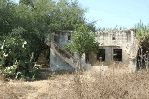
One undemolished house stood approximately 10 metres from the entrance. Beside it were the remains of another house and several cactus plants. A dirt road bordered by cactus, olive, and almond trees ran along the southern boundary of the fence. Eucalyptus trees had also been planted inside and outside the enclosed area.
Sources
- PalQuest, “Yasur”.
- Palestine Remembered, “Yasur—Gaza”.
- Institute for Palestine Studies, Walid Khalidi’s All That Remains.
- Pal48, “The Depopulated Palestinian Village of Yasur”.
- Government of Palestine, Report and General Abstracts of the Census of 1922.
- Government of Palestine, Census of Palestine, 1931.
- Government of Palestine, Village Statistics, April 1945.
- Walid Khalidi, ed., All That Remains: The Palestinian Villages Occupied and Depopulated by Israel in 1948 (Washington, DC: Institute for Palestine Studies, 1992).
Photo gallery


Photos from the village's people
Photos sent in by visitors and published after review.
Add a photo of this village
Log in to add photos of this village.
Other villages from Gaza
 Download Our Palestine App
The whole archive in the palm of your hand: depopulated villages, the Nakba, the massacres and Al-Aqsa — free, with no ads to erase the story.
Download Our Palestine App
The whole archive in the palm of your hand: depopulated villages, the Nakba, the massacres and Al-Aqsa — free, with no ads to erase the story.



Comments
No comments yet — be the first to write one.
Add your comment
Name and email are optional. Comments appear after review.