
The depopulated village of Al-Masmiyya al-Kabira / District of Gaza

Subdistrict: Gaza
Estimated population of al-Masmiyya al-Kabira in 1948: 2,923
Occupation and depopulation: 8–9 July 1948; the village was reported as occupied by 11 July
Military operation: Operation An-Far
Occupying force: Givati Brigade
Israeli settlements established on village land before 1948: None
Israeli settlements established on village land after 1948: Bnei Re'em, Hatzav, Yinon, and Ahva
Other installations established on village land: Mashmi'at Shalom and Chawwat Berurim state-sponsored farms
Overview of al-Masmiyya al-Kabira
Al-Masmiyya al-Kabira, also known simply as al-Masmiyya, was a Palestinian village on the southern coastal plain in the Gaza Subdistrict. It lay south of al-Ramla and approximately two kilometres west of its smaller sister village, al-Masmiyya al-Saghira. The village was occupied and its inhabitants were displaced during Israel’s occupation of Palestine in the 1948 Nakba.
The qualifier al-Kabira, meaning “the large” or “the major,” was added to distinguish the village from al-Masmiyya al-Saghira.
The village was located approximately 41 kilometres northeast of Gaza and stood at an average elevation of about 75 metres above sea level. A wadi bordered it to the north. Its location was strategically important because it lay near the junction of roads leading southwest to al-Majdal, northeast to al-Ramla, and toward the Jerusalem–Jaffa road.
Boundaries of al-Masmiyya al-Kabira
Al-Masmiyya al-Kabira was surrounded by the following Palestinian villages:
- North: Qatra.
- Northwest: Bashshit.
- West: Yasur.
- Southwest: Qastina.
- South: Tall al-Turmus.
- Southeast: Tall al-Safi.
- East: Al-Masmiyya al-Saghira.
- Northeast: Al-Khayma.
Architecture of al-Masmiyya al-Kabira
In the late nineteenth century, al-Masmiyya al-Kabira had a roughly trapezoidal plan, with the long base of the trapezoid facing west. Gardens surrounded the village, and its houses were constructed of adobe bricks or concrete. Later building activity extended primarily toward the west and southwest.
Landmarks and Public Facilities
Al-Masmiyya al-Kabira contained several important public and community facilities:
- A village council responsible for administering local public and social affairs.
- Two mosques, one in the quarter associated with the Muhanna family and another in the quarter associated with the Yaghi family.
- A petrol station.
- A small clinic.
- A weekly market held every Thursday, which attracted residents of al-Masmiyya al-Saghira, Yasur, Qastina, Bashshit, Qatra, and other neighbouring villages.
Education in al-Masmiyya al-Kabira
The village had two mosques and two schools, one for boys and another for girls. The boys’ school was founded in 1922 and subsequently developed into a complete elementary school. By the mid-1940s, it had 307 pupils distributed across seven grades and taught by eight teachers. The village contributed toward the salary of one of those teachers.
The girls’ school was established in 1944. By the mid-1940s, it had 39 pupils taught by one government-funded teacher. A local account estimated that approximately 350 men in the village were literate.
Economic Life in al-Masmiyya al-Kabira
Agriculture formed the basis of the village economy, with cereals and citrus fruit as the principal crops. In 1944/45, 1,005 dunams were devoted to citrus and bananas, 18,082 dunams under Palestinian ownership were allocated to cereal cultivation, and 597 dunams were irrigated or used for orchards.
In addition to farming, residents raised livestock and poultry. Some villagers were employed at a nearby British military camp. Al-Masmiyya al-Kabira also had a petrol station, while its Thursday market served as an important commercial centre for the surrounding rural communities.
Land of al-Masmiyya al-Kabira
The village’s lands covered 20,687 dunams, including a built-up area of 135 dunams. Palestinian ownership amounted to 19,850 dunams, Jewish ownership to 229 dunams, and public land to 608 dunams. Citrus trees were planted on 1,005 dunams, all under Palestinian ownership. Wells used for domestic and agricultural purposes reportedly ranged from approximately 20 to 50 metres in depth.
Land Ownership in al-Masmiyya al-Kabira
| Ownership category | Land area (dunams)* |
|---|---|
| Palestinian ownership | 19,850 |
| Jewish ownership | 229 |
| Public land | 608 |
| Total | 20,687 |
* One dunam equals approximately 1,000 square metres.
Land Use in al-Masmiyya al-Kabira, 1944/45
| Land-use category | Palestinian ownership (dunams)* | Jewish ownership (dunams)* | Public land (dunams)* | Total (dunams)* |
|---|---|---|---|---|
| Citrus and bananas | 1,005 | 0 | 0 | 1,005 |
| Irrigated land and orchards | 597 | 0 | 0 | 597 |
| Cereal cultivation | 18,082 | 229 | 4 | 18,315 |
| Built-up area | 135 | 0 | 0 | 135 |
| Cultivable land | 19,684 | 229 | 4 | 19,917 |
| Uncultivated land | 31 | 0 | 604 | 635 |
* One dunam equals approximately 1,000 square metres.
The figures above preserve the ownership categories recorded in the British Mandate village statistics. Earlier compilations sometimes combined public land with Palestinian land, producing slightly different cereal and cultivable-land totals.
Population of al-Masmiyya al-Kabira
| Year | Population |
|---|---|
| 1922 | 1,390 |
| 1931 | 1,756 |
| 1945 | 2,520 |
| 1948 | 2,923 (estimated) |
| Estimated number of refugees in 1998 | 17,952 |
The 1948 and 1998 figures are later demographic estimates rather than contemporary census counts.
Number of Houses in al-Masmiyya al-Kabira
| Year | Number of houses |
|---|---|
| 1931 | 354 |
| 1948 | 589 (estimated) |
The figure for 1948 is a later estimate rather than an official housing census.
Occupation and Depopulation of al-Masmiyya al-Kabira
Al-Masmiyya al-Kabira was occupied by the Givati Brigade during Operation An-Far in July 1948. Sources differ slightly over the precise date. Palestinian village records commonly give the night of 8–9 July, while a contemporary report published by The New York Times stated that the village had been occupied by 11 July. The occupation obstructed an Egyptian attempt to advance toward al-Latrun from the direction of al-Majdal.
Walid Khalidi records that the village was taken during military operations conducted behind the Givati Brigade’s front line. The stated objective of these operations was to remove Palestinian population centres regarded by the attacking forces as a threat to their rear. The military assault resulted in the displacement of al-Masmiyya al-Kabira’s Palestinian inhabitants.
Accordingly, 8–9 July 1948 is the most widely cited period for the village’s occupation, while 11 July represents the latest date by which its capture had been publicly reported. Estimates therefore vary slightly between sources.
Israeli Settlements and Installations on the Land of al-Masmiyya al-Kabira
Academic village surveys identify four Israeli settlements and two state-sponsored agricultural farms established on the land of al-Masmiyya al-Kabira:
- Bnei Re'em, originally called Kerem Re'em, established in 1949.
- Hatzav, established in 1949.
- Yinon, established in 1952.
- Ahva, established in 1976.
- Mashmi'at Shalom, a state-sponsored agricultural farm established during the 1950s.
- Chawwat Berurim, another state-sponsored agricultural farm established during the 1950s.
Some local and later compilations also associate the names Masmiyya A, Masmiyya B, Sha'arei Avraham, and Talmei Yehiel with the broader area. The principal academic sources, however, do not consistently identify all of them as separate settlements established on al-Masmiyya al-Kabira’s registered land. They have therefore not been presented here as confirmed village-land settlements.
Al-Masmiyya al-Kabira Today
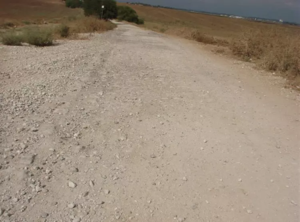
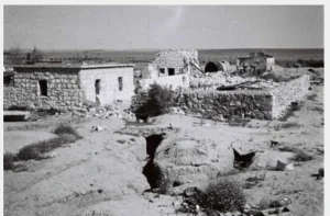
The two village schools and several houses remain standing. The girls’ school has been left deserted, while the boys’ school was converted into an Israeli military installation. Some surviving houses are inhabited, while others have been converted into warehouses. One house has been used as a shop selling juice.
The surviving buildings are generally made of concrete and have simple architectural features, including flat roofs and rectangular doors and windows. A date palm grows in the courtyard of a house that belonged to the Palestinian villager Tawfiq al-Rabi.
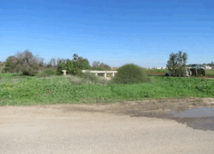
An Israeli petrol station stands on the site of the village’s former petrol station, which had belonged to Hasan Abd al-Aziz and Nimr Muhanna. The surrounding land is cultivated by Israeli farmers.
Sources
- PalQuest: Al-Masmiyya al-Kabira.
- Palestine Remembered: Al-Masmiyya al-Kabira.
- Institute for Palestine Studies: Walid Khalidi’s All That Remains.
- Visualizing Palestine: The Story of al-Masmiyya al-Kabira.
- Maha Mehanna: The Story of al-Masmiyya al-Kabira as I Know It.
- Government of Palestine, Report and General Abstracts of the Census of 1922.
- Government of Palestine, Census of Palestine, 1931: Population of Villages, Towns and Administrative Areas.
- Government of Palestine, Department of Statistics, Village Statistics, April 1945.
- Walid Khalidi, ed., All That Remains: The Palestinian Villages Occupied and Depopulated by Israel in 1948, Institute for Palestine Studies, 1992, pp. 125–126.
- Benny Morris, The Birth of the Palestinian Refugee Problem Revisited, Cambridge University Press, 2004.
Photo gallery


Photos from the village's people
Photos sent in by visitors and published after review.
Add a photo of this village
Log in to add photos of this village.
Other villages from Gaza
 Download Our Palestine App
The whole archive in the palm of your hand: depopulated villages, the Nakba, the massacres and Al-Aqsa — free, with no ads to erase the story.
Download Our Palestine App
The whole archive in the palm of your hand: depopulated villages, the Nakba, the massacres and Al-Aqsa — free, with no ads to erase the story.



Comments
No comments yet — be the first to write one.
Add your comment
Name and email are optional. Comments appear after review.