
The depopulated village of Al-Sakhina / District of Baysan
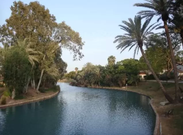
Subdistrict: Baysan Subdistrict
Estimated Palestinian population of al-Sakhina in 1948: 615, sometimes rounded to approximately 620
Probable date of occupation and depopulation: 12 May 1948
Israeli settlements established on al-Sakhina’s land before 1948: Tel Amal, established in 1936 and later renamed Nir David
Israeli settlements established on the village site after 1948: None
- Al-Sakhina was located approximately 5 kilometres west of Baysan.
- The village stood in the middle of a plain bordered by three archaeological mounds: Tall al-Dahra al-Kabir to the north, Tall al-Dahra al-Saghir to the south, and Tall Amal, also to the south.
- The al-Faqqu'a Mountains, also known as the Jilbu' Hills, extended south of the village. The Jalud River crossed al-Sakhina’s land on its way towards the Jordan River.
- The main road to Baysan passed through the village, while a secondary road connected it with the nearby village of al-Murassas. Numerous springs were found in the surrounding area.
Boundaries of al-Sakhina
Al-Sakhina was situated among the following Palestinian villages and towns:
- North: al-Murassas.
- West: Qumya.
- Southwest: Faqqu'a.
- South: Khirbat al-Jawfa.
- East: Baysan.
Population of al-Sakhina
Al-Sakhina had 374 inhabitants in the 1931 British Mandate census. In 1945, its Palestinian population was recorded as 530, all of whom were Muslims. The inhabitants included families belonging to al-Qurut, al-Muqbil al-Zubaydi, and Arab al-Saqr.
The official 1945 statistical unit also included 290 Jewish residents of the neighbouring settlement of Tel Amal, later renamed Nir David, producing a combined total of 820. These residents should not be presented as part of the Palestinian village population itself. The village’s Palestinian population in 1948 has been estimated at 615, sometimes rounded to approximately 620.
Economic and Agricultural Life in al-Sakhina
The inhabitants of al-Sakhina worked primarily in agriculture. Vegetables were cultivated along the southern bank of the Jalud River, while grapes and other fruit trees were grown elsewhere on the village lands. Date palms were tended in the eastern part of the village, and a forest occupied a substantial area to the northwest.
According to the 1944–1945 land statistics, 828 dunams under Palestinian ownership were irrigated or planted with orchards, while 260 dunams were devoted to cereal cultivation. The wider statistical totals included the land of Tel Amal, which must be distinguished from land under Palestinian ownership.
Land Ownership in al-Sakhina
| Ownership category | Land area (dunams)* |
|---|---|
| Palestinian ownership | 1,088 |
| Jewish ownership | 4,985 |
| Public land | 327 |
| Total | 6,400 |
* One dunam equals approximately 1,000 square metres. The official 1944–1945 statistical unit included Tel Amal, later renamed Nir David.
Land Use in al-Sakhina
| Land-use category | Palestinian ownership (dunams)* | Jewish ownership (dunams)* | Public land (dunams)* | Total (dunams)* |
|---|---|---|---|---|
| Irrigated land and orchards | 828 | 3,761 | 0 | 4,589 |
| Cereal cultivation | 260 | 1,164 | 47 | 1,471 |
| Built-up area | 0 | 60 | 0 | 60 |
| Cultivable land | 1,088 | 4,925 | 47 | 6,060 |
| Uncultivated land | 0 | 0 | 280 | 280 |
* One dunam equals approximately 1,000 square metres. The figures include the land of Tel Amal within the wider 1944–1945 statistical unit.
Population Records for al-Sakhina
| Year | Palestinian population* | Jewish population of Tel Amal* | Combined statistical total* |
|---|---|---|---|
| 1931 | 374 | — | 374 |
| 1945 | 530 | 290 | 820 |
| 1948 | 615 | Not applicable | Not applicable |
| Estimated number of Palestinian refugees in 1998 | 3,776 | Not applicable | Not applicable |
* The 1945 combined total includes 290 Jewish residents of Tel Amal. The figures for the Palestinian population in 1948 and the number of refugees in 1998 are demographic estimates rather than contemporaneous census counts. Estimates vary between sources.
Number of Houses in al-Sakhina
| Year | Number of houses* |
|---|---|
| 1931 | 78 |
| 1948 | 128 |
* The 1931 figure is an official census count, while the 1948 figure is an estimate.
Archaeological Remains in al-Sakhina
The village area contained archaeological mounds and sites with ruins, building foundations, columns, and paved floors. Nearby archaeological features included Tall Tummas, Tall al-Dahra al-Kabir, and Tall al-Dahra al-Saghir. The available sources describe these remains but do not provide a definitive date or detailed archaeological classification for all of them.
Occupation and Depopulation of al-Sakhina
The precise date on which al-Sakhina was occupied and depopulated is not conclusively documented. Walid Khalidi’s account states that two neighbouring villages were occupied on 12 May 1948 and that al-Sakhina may have fallen at approximately the same time. This was also the day on which Israeli forces of the Golani Brigade occupied the Palestinian town of Baysan during Operation Gideon, a broader military campaign conducted throughout the Baysan Valley during Israel’s occupation of Palestine in the Nakba.
Accordingly, 12 May 1948 is the most widely cited probable date for the occupation and depopulation of al-Sakhina. The date of 1 May 1948 given in some secondary listings is not supported by the principal academic account and should not be presented as certain.
Israeli Settlements Established on the Land of al-Sakhina
The Israeli settlement now known as Nir David was established in 1936 under the name Tel Amal. It lies immediately south of the former village site on land that traditionally belonged to al-Sakhina. No additional Israeli settlement is documented as having been established directly on the village site after 1948.
Al-Sakhina Today
No identifiable structures from the Palestinian village remain at the site. The area was ploughed and converted into agricultural fields, and the lands of al-Sakhina are cultivated by the residents of Nir David.
Sources
- Interactive Encyclopedia of the Palestine Question – al-Sakhina.
- Palestine Remembered – al-Sakhina.
- Government of Palestine, Village Statistics, April 1945.
- Walid Khalidi, All That Remains: The Palestinian Villages Occupied and Depopulated by Israel in 1948, Institute for Palestine Studies, 1992, pp. 131–132.
- Government of Palestine, Census of Palestine, 1931: Population of Villages, Towns and Administrative Areas.
Photo gallery


Photos from the village's people
Photos sent in by visitors and published after review.
Add a photo of this village
Log in to add photos of this village.
Other villages from Baysan
 Download Our Palestine App
The whole archive in the palm of your hand: depopulated villages, the Nakba, the massacres and Al-Aqsa — free, with no ads to erase the story.
Download Our Palestine App
The whole archive in the palm of your hand: depopulated villages, the Nakba, the massacres and Al-Aqsa — free, with no ads to erase the story.



Comments
No comments yet — be the first to write one.
Add your comment
Name and email are optional. Comments appear after review.