
The depopulated village of Ijzim / District of Haifa

Subdistrict: Haifa
Estimated population of Ijzim in 1948: Approximately 3,445–3,450
Date of occupation and depopulation: 26 July 1948
Military campaign: Operation Shoter
Military units: Forces drawn from the Golani, Carmeli, and Alexandroni brigades
Israeli settlement established on the village site after 1948: Kerem Maharal
Ijzim was located approximately 19.5 kilometres south of Haifa. The figure of 28 kilometres cited in some accounts is not consistent with the distance recorded in the principal Palestinian geographical references.
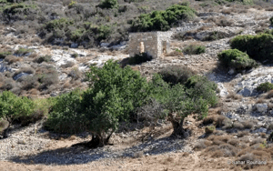
Ijzim was a depopulated Palestinian village in the Haifa Subdistrict. The Israeli settlement of Kerem Maharal was established on the village site in 1949. Several Palestinian houses and other buildings remain standing, and some have been adapted for use by the settlement’s residents.
The village stood on a hilltop in the southwestern part of Mount Carmel. A plain bordered it to the northeast, while the broad Wadi Abu Madi lay to the south. A secondary road connected Ijzim to the main coastal highway, which passed approximately 3 kilometres west of the village.
Ijzim was the second-largest village in the Haifa Subdistrict in terms of land area. Most of its houses were constructed from stone and cement and extended along a north–south axis.
Boundaries of Ijzim
Ijzim was situated among the following Palestinian villages and localities:
- To the north: Ayn Hawd.
- To the west: Jaba‘.
- To the southwest and south: Ayn Ghazal.
- To the east: Umm al-Zinat.
- To the northeast: Daliyat al-Karmel.

Landmarks of Ijzim
Until its occupation in 1948, Ijzim contained a number of important buildings and institutions, including:
- A boys’ elementary school established during the Ottoman period. Some local accounts also refer to educational provision for girls, although the available Mandate-era references do not clearly document a separate girls’ school.
- Two mosques.
- A village coffeehouse.
- A cemetery.
- Three traditional olive presses and one mechanical olive press.
- The fortified residence and diwan of Shaykh Mas‘ud al-Madi, a prominent nineteenth-century Palestinian leader from Ijzim.
Population of Ijzim
Ottoman tax records from 1596 estimated the village’s population at 55. In 1859, the British vice-consul Edward Thomas Rogers estimated that Ijzim had approximately 1,000 inhabitants.
The British Mandate census of 1922 recorded 1,610 inhabitants. The population rose to 2,160 in the 1931 census, when 442 houses were recorded. The 1931 total included several surrounding localities associated administratively with Ijzim: Khirbat Qumbaza, Khirbat al-Manara, Shaykh al-Burayk, al-Mazar, and al-Washahiyya.
In 1944/45, Ijzim had 2,970 inhabitants, including approximately 140 Christians; the remainder were Muslims. A demographic projection places the village’s population in 1948 at approximately 3,445–3,450. The descendant refugee population was estimated at 21,157 in 1998, although this was a demographic projection rather than an official census.
Population Figures for Ijzim
| Year | Population* |
|---|---|
| 1596 | Approximately 55 |
| 1859 | Approximately 1,000 |
| 1922 | 1,610 |
| 1931 | 2,160 |
| 1944/45 | 2,970 |
| 1948 estimate | Approximately 3,445–3,450 |
| Estimated descendant refugee population in 1998 | 21,157 |
* The 1596 and 1859 figures are historical estimates. The 1922 and 1931 figures are census results, while the 1944/45 figure comes from official British Mandate statistics. The figures for 1948 and 1998 are demographic estimates.
Houses in Ijzim
| Year | Number of houses* |
|---|---|
| 1931 | 442 |
| 1948 estimate | Approximately 704 |
* The figure for 1931 is a documented census count and includes the associated localities listed above. The 1948 figure is a later estimate rather than an official count.
The Lands of Ijzim
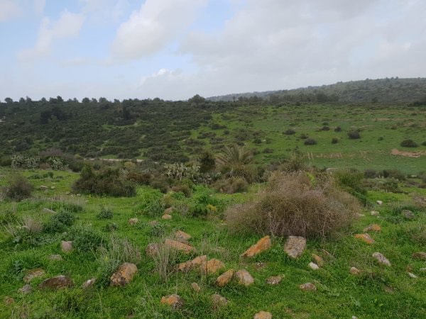
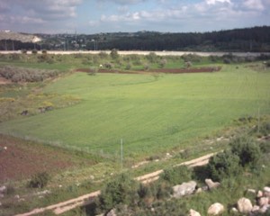
Ijzim’s lands covered 46,905 dunams, making it the second-largest village in the Haifa Subdistrict by land area. Part of the village land consisted of plains cultivated with cereals, vegetables, and tobacco. Other areas, including the hill country, were planted with fruit trees, olives, and figs. The lands of Ijzim bordered those of Umm al-Zinat, Daliyat al-Karmel, Ayn Hawd, al-Mazar, Jaba‘, and Ayn Ghazal.
Land Ownership in Ijzim, 1944/45
| Ownership category | Land area in dunams* |
|---|---|
| Palestinian ownership | 23,619 |
| Jewish ownership | 0 |
| Public land | 23,286 |
| Total | 46,905 |
* One dunam equals approximately 1,000 square metres.
Land Use in Ijzim, 1944/45
| Land-use category | Palestinian-owned land (dunams)* | Public land (dunams)* | Total (dunams)* |
|---|---|---|---|
| Irrigated land and orchards | 2,367 | 0 | 2,367 |
| Olive groves in 1942/43* | 1,340 | 0 | 1,340 |
| Cereal cultivation | 17,791 | 0 | 17,791 |
| Built-up area | 91 | 0 | 91 |
| Cultivable land | 20,158 | 0 | 20,158 |
| Uncultivated land | 3,370 | 23,286 | 26,656 |
* The olive-grove figure is included within the irrigated-land and orchard category and should not be added separately to the cultivable-land total. One dunam equals approximately 1,000 square metres.
Economic Life in Ijzim
Ijzim’s lands contained several springs, wadis, and wells. Its inhabitants depended primarily on agriculture and animal husbandry, including poultry raising. Cereals were the village’s most important crops, although Ijzim was also renowned for its olive groves, which covered approximately 1,340 dunams in 1942/43.
In 1944/45, 17,791 dunams were devoted to cereal cultivation, while 2,367 dunams were irrigated or used for orchards. The village contained three manually operated olive presses and one mechanical press.
Ijzim was constructed over the remains of an earlier settlement. Archaeological remains were also found at nearby Khirbat Kabbara and Khirbat Maqura, neither of which had undergone systematic excavation by the time the principal historical survey of the village was compiled.
Education in Ijzim
Historical sources record that Ijzim had a boys’ elementary school established during the Ottoman period, around 1880–1888. The school closed during the First World War and subsequently reopened. By 1942, its highest level of instruction was the fourth elementary grade. Some local accounts mention separate education for girls, but further documentary evidence would be required to confirm the existence and status of a separate girls’ school before the Nakba.
Archaeological Remains in Ijzim
Ijzim occupied an archaeological site containing a mound of accumulated ruins associated with earlier periods of settlement. Several archaeological localities surrounded the village, including Khirbat Kabbara and Khirbat Maqura.
The People of Ijzim in Exile
After the village’s occupation and depopulation, many displaced inhabitants travelled eastward toward Jenin. Families from Ijzim settled in Jenin refugee camp and Nur Shams refugee camp, while others were displaced farther afield to Iraq, Jordan, Syria, and Lebanon.
Community histories record the presence of families from Ijzim in Yarmouk, Daraa, al-Raml, Ayn al-Tall, and Latakia refugee camps, as well as in other Palestinian refugee communities in Lebanon and northern Jordan. These destinations reflect the multiple routes taken by the village’s displaced families during and after the Nakba.
Occupation and Depopulation of Ijzim
Ijzim, Ayn Ghazal, and Jaba‘ formed a Palestinian defensive area south of Haifa known as the “Little Triangle.” The three villages continued to resist Israeli attacks until late July 1948 and obstructed Israeli military movement along the coastal road.
Israeli forces made two unsuccessful attempts to occupy the area on 18 June and 8 July 1948. A third assault, designated Operation Shoter—literally “Policeman”—began on 24 July. Although presented as a policing action, it was a military operation conducted during the second truce in Palestine.
Forces drawn from the Golani, Carmeli, and Alexandroni brigades participated in the operation. The villages were subjected to aerial and artillery bombardment before being occupied on 26 July 1948. Most of the inhabitants who remained were expelled or fled eastward under military pressure. Palestinian villagers later testified that soldiers and aircraft fired on displaced residents as they left the area.
Reports concerning casualties across Ijzim, Ayn Ghazal, and Jaba‘ vary considerably. A preliminary investigation recorded only two recovered bodies, while a later United Nations investigation placed the combined number of Palestinians killed or missing from the three villages at approximately 130. These figures relate to the entire Little Triangle and cannot be attributed exclusively to Ijzim.
United Nations mediator Count Folke Bernadotte reported that the villagers had attempted to negotiate before the assault. In September 1948, he called for the refugees from the three villages to be allowed to return and for their damaged homes to be rebuilt. Israel did not implement this demand.
Ijzim Today
Ijzim was partially destroyed after its occupation. The surviving mosque was left to deteriorate, although several Palestinian houses remain standing and are used by residents of Kerem Maharal.
The two-storey diwan of Shaykh Mas‘ud al-Madi, constructed during the eighteenth century, was converted into a museum. The village school was converted into a synagogue, while the former coffeehouse became a post office. The surrounding plain is cultivated by residents of the Israeli settlement, and parts of the mountainous land have been converted into recreational parks.
Sources and References
- Interactive Encyclopedia of the Palestine Question: Ijzim
- Interactive Encyclopedia of the Palestine Question: Ethnic Cleansing During the Second Truce
- Walid Khalidi, ed., All That Remains: The Palestinian Villages Occupied and Depopulated by Israel in 1948, Institute for Palestine Studies.
- Nafez Nazzal, The Palestinian Exodus from Galilee, 1948, Institute for Palestine Studies, Beirut, 1978.
- Institute for Palestine Studies: Jaba‘ Village and the Palestinian Little Triangle
- Palestine Remembered: Ijzim, Haifa Subdistrict
- Government of Palestine, Village Statistics, April 1945, population, land-ownership, and land-use tables for Ijzim.
- United Nations Security Council records and reports concerning the attack on Ijzim, Ayn Ghazal, and Jaba‘ during the second truce in Palestine.
Photo gallery


Photos from the village's people
Photos sent in by visitors and published after review.
Add a photo of this village
Log in to add photos of this village.
Other villages from Haifa

 Download Our Palestine App
The whole archive in the palm of your hand: depopulated villages, the Nakba, the massacres and Al-Aqsa — free, with no ads to erase the story.
Download Our Palestine App
The whole archive in the palm of your hand: depopulated villages, the Nakba, the massacres and Al-Aqsa — free, with no ads to erase the story.



Comments
No comments yet — be the first to write one.
Add your comment
Name and email are optional. Comments appear after review.