
The depopulated village of Al-Farradiyya / District of Safed
Subdistrict: Safad
Estimated population of al-Farradiyya in 1948: Approximately 780
Date of occupation: 30 October 1948; the remaining inhabitants were expelled in February 1949
Israeli settlements established on al-Farradiyya’s lands before 1948: None
Israeli settlements established on al-Farradiyya’s lands after 1948: Parod and Shefer
Al-Farradiyya was a depopulated Palestinian village located approximately 8 kilometres southwest of the city of Safad.
During the Nakba, the village came under Israeli control, its Palestinian inhabitants were displaced, and its homes were subsequently destroyed. The Israeli settlement of Parod was established on village land in 1949, followed by Shefer in 1950.
Al-Farradiyya stood on the southern slope of Mount Zabud, while the main Nazareth–Safad road passed immediately to its north.
The inhabitants cultivated small gardens and grew figs and olives. The population was predominantly Muslim, and the village had an elementary school for boys. Al-Farradiyya was also known for an agricultural extension centre that advised farmers from the Acre and Safad subdistricts on poultry production and beekeeping.
Boundaries of al-Farradiyya
Al-Farradiyya was situated among the following Palestinian villages and localities:
- Mirun to the north.
- Al-Sammu‘i to the northeast.
- Al-Shuna and Al-Zahiriyya al-Tahta to the east.
- Ayn al-Asad, in the Acre Subdistrict, to the west.
- Mi‘ar, in the Acre Subdistrict, to the south.
- Kafr ‘Inan, in the Acre Subdistrict, to the southwest.
- Bayt Jann, in the Acre Subdistrict, to the northwest.
Population of al-Farradiyya
According to the British Mandate census of 1922, al-Farradiyya had 362 inhabitants, all of whom were Muslims. The 1931 census recorded 465 inhabitants—464 Muslims and one Christian—living in 101 houses. The official Village Statistics for 1945 recorded a population of 670 Muslims. A later demographic projection placed the village’s population in 1948 at approximately 777–780 inhabitants. The figure of 168 houses in 1948 is likewise an estimate rather than a census count. The number of refugees descended from the village population was estimated at 4,773 in 1998.
Population Figures for al-Farradiyya
| Year | Population* |
|---|---|
| 1596 | 237 |
| Late nineteenth century | Approximately 150 |
| 1922 | 362 |
| 1931 | 465 |
| 1945 | 670 |
| 1948 estimate | Approximately 777–780 |
| Estimated refugee population in 1998 | 4,773 |
* The figures for 1596 and the late nineteenth century are historical estimates. The figures for 1922 and 1931 derive from British Mandate censuses, while the 1945 figure comes from the official Village Statistics. The 1948 and 1998 figures are demographic estimates.
Number of Houses in al-Farradiyya
| Year | Number of houses |
|---|---|
| 1931 | 101 |
| 1948 estimate | 168 |
Economic Life in al-Farradiyya
Agriculture formed the principal basis of the village economy. In 1944/45, approximately 5,365 dunams of al-Farradiyya’s land were classified as cultivable. The recorded agricultural uses included:
- 1,182 dunams devoted to irrigated land and orchards.
- 703 dunams planted with olive trees; this area formed part of the village’s orchard cultivation and should not be added separately to the cultivable-land total.
- 4,183 dunams used for cereal cultivation, including 4,137 dunams under Palestinian ownership and 46 dunams of public land.
Al-Farradiyya was an important and productive agricultural centre. It contained a model experimental farm covering approximately 300 dunams. Established during the 1930s, the farm was supervised by a Palestinian agronomist who had completed graduate studies at the University of Montpellier in France and began working at the station in 1932. The farm was created to improve varieties of apples, figs, grapes, apricots, pears, and almonds, as well as to develop new seed varieties. It also contained a nursery in which approximately 2,000 plants were raised for distribution to Palestinian farmers. The centre provided agricultural extension services to farmers in the Acre and Safad subdistricts, particularly in poultry production and beekeeping.
Education in al-Farradiyya
Formal education in the village was available to boys, who attended an elementary school established during the British Mandate. Instruction extended through the fourth elementary grade. Students wishing to continue their education generally attended schools in Safad or other Palestinian towns and cities.
Land Ownership in al-Farradiyya
| Ownership category | Land area in dunams* |
|---|---|
| Palestinian ownership | 15,228 |
| Jewish ownership | 0 |
| Public land | 4,519 |
| Total | 19,747 |
* One dunam equals approximately 1,000 square metres.
Land Use in 1944/45
| Land-use category | Palestinian-owned land (dunams)* | Public land (dunams)* | Total (dunams)* |
|---|---|---|---|
| Irrigated land and orchards | 1,182 | 0 | 1,182 |
| Olive groves, included within orchard cultivation | 703 | 0 | 703 |
| Cereal cultivation | 4,137 | 46 | 4,183 |
| Built-up area | 25 | 0 | 25 |
| Cultivable land | 5,319 | 46 | 5,365 |
| Uncultivated land | 9,884 | 4,473 | 14,357 |
* One dunam equals approximately 1,000 square metres.
Landmarks of al-Farradiyya
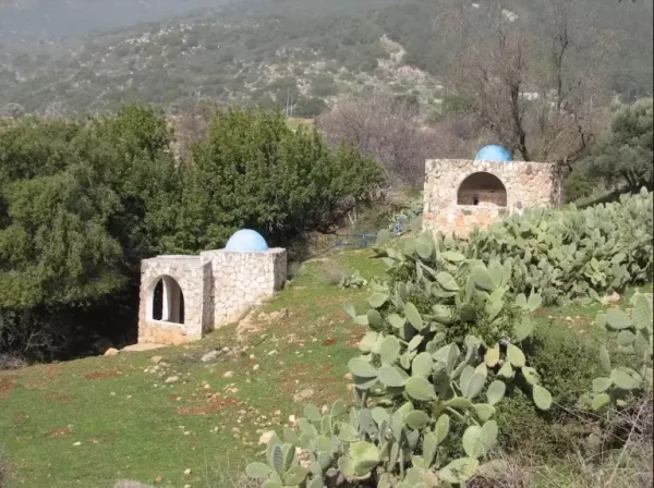
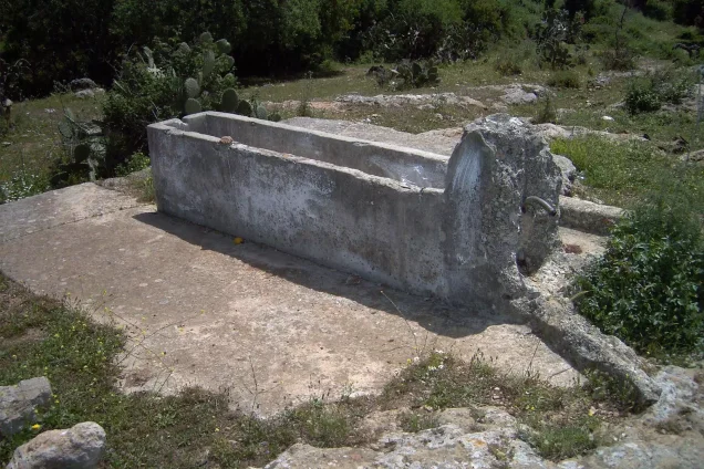
The village’s principal landmarks included the model experimental farm established during the 1930s; one mosque; an elementary boys’ school in which instruction extended through the fourth grade; several water-powered mills; and the shrine, or maqam, of al-Shaykh Mansur. Historical sources also record the remains of an aqueduct in the vicinity of the village.
Occupation and Depopulation of al-Farradiyya
In early May 1948, Palestinians from neighbouring villages, particularly ‘Akbara and Al-Zahiriyya al-Tahta, sought refuge in al-Farradiyya while fleeing the advance associated with Operation Yiftach. The village did not come under Israeli control until 30 October 1948, during Operation Hiram, when units of the Golani Brigade advanced northward from ‘Aylabun toward Sa‘sa‘. Al-Farradiyya appears not to have been subjected to a direct assault at that stage, but it was surrounded by Israeli forces.
Because the village was not immediately attacked, many residents remained in their homes after October 1948. On 15 December 1948, Israeli authorities endorsed a proposal to expel the 261 inhabitants who remained in al-Farradiyya and nearby Kafr ‘Inan. The expulsion was implemented in February 1949. Some villagers were displaced to other Palestinian communities in the Galilee under Israeli control, while others were expelled to the Triangle area of the West Bank. Accordingly, 30 October 1948 marks the village’s occupation during the Nakba, whereas February 1949 marks its final depopulation.
Israeli Settlements on the Lands of al-Farradiyya
Israel established the following settlements on the village’s lands:
- Parod was established in 1949 on al-Farradiyya’s land, approximately 300 metres east of the site of the destroyed village.
- Shefer was established in 1950 on village land to the north of the site.
The settlement of Qaddarim was established east of the village site in 1980. It was subsequently relocated southeastward in 1987.
Al-Farradiyya Today
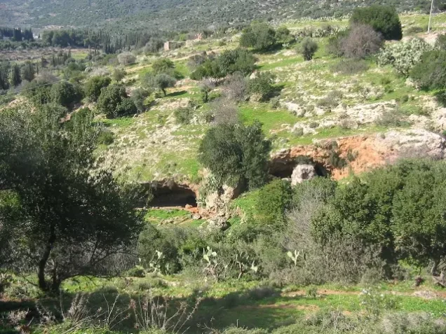
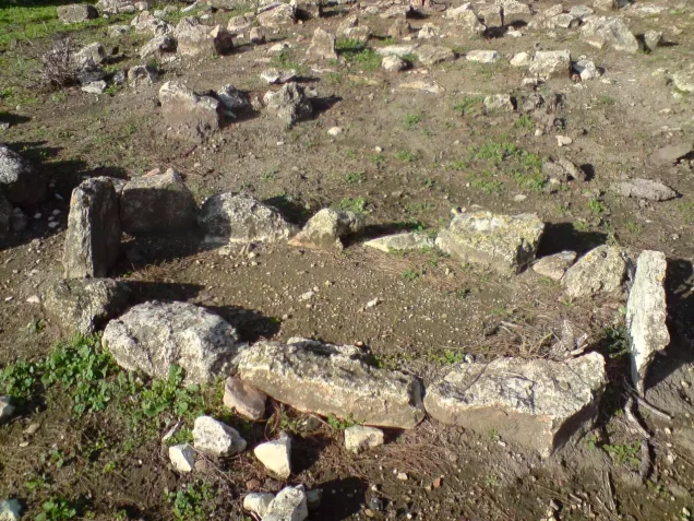
The village site is deserted and covered with wild thorny vegetation, trees, and piles of stones from the destroyed houses. Cactuses grow on the surrounding land, much of which is used for grazing livestock. Some sections have been planted with trees and converted into recreational areas for Israelis.
Sources and References
Photo gallery








Photos from the village's people
Photos sent in by visitors and published after review.
Add a photo of this village
Log in to add photos of this village.
Other villages from Safed



 Download Our Palestine App
The whole archive in the palm of your hand: depopulated villages, the Nakba, the massacres and Al-Aqsa — free, with no ads to erase the story.
Download Our Palestine App
The whole archive in the palm of your hand: depopulated villages, the Nakba, the massacres and Al-Aqsa — free, with no ads to erase the story.



Comments
No comments yet — be the first to write one.
Add your comment
Name and email are optional. Comments appear after review.