
The depopulated village of Al-Mansura (Safed) / District of Safed

Subdistrict: Safad
Estimated population in 1948: 418
Date of occupation and depopulation: 25 May 1948
Military operation: Operation Yiftach
Military force: Haganah forces, including Palmach units operating in the Safad region
Israeli settlements established on village land before 1948: She'ar Yashuv, established in 1940
Israeli settlements established on the built-up site after 1948: None
Al-Mansura was a depopulated Palestinian village in the Safad Subdistrict, situated approximately 31 kilometres northeast of the city of Safad. It stood near the western bank of the Banyas River and close to Palestine’s former boundary with Syria. The village name, al-Mansura, is derived from the Arabic root associated with victory.
The village occupied level ground surrounded by agricultural land. Nineteenth-century travellers described it as a settlement of stone-and-mud houses built on a plain near a river. Its modern inhabitants were all Muslims. Several archaeological tells and khirbas were located in its vicinity.
Boundaries of al-Mansura
Al-Mansura was situated among the following Palestinian villages and localities:
- North: al-Shawka al-Tahta.
- West: al-Khisas.
- Southwest: Qaytiyya.
- South: al-‘Abisiyya.
- East: the Syrian Golan, occupied by Israel since 1967.
Economic Life in al-Mansura
Al-Mansura’s economy depended principally on agriculture and livestock raising. The village was surrounded by cultivated land, and in 1944/45, 1,249 dunams under Palestinian ownership were irrigated or used for orchards. A further 175 dunams in the same land-use category were under Jewish ownership.
Land Ownership in al-Mansura
| Ownership category | Land area (dunams)* |
|---|---|
| Palestinian ownership | 1,254 |
| Jewish ownership | 175 |
| Public land | 115 |
| Total | 1,544 |
* One dunam equals approximately 1,000 square metres.
Land Use in al-Mansura in 1945
| Land-use category | Palestinian ownership (dunams)* | Jewish ownership (dunams)* | Public land (dunams)* | Total (dunams)* |
|---|---|---|---|---|
| Irrigated land and orchards | 1,249 | 175 | 0 | 1,424 |
| Built-up area | 5 | 0 | 0 | 5 |
| Cultivable land | 1,249 | 175 | 0 | 1,424 |
| Uncultivated land | 0 | 0 | 115 | 115 |
* One dunam equals approximately 1,000 square metres.
Population of al-Mansura
| Year | Population |
|---|---|
| 1931 | 89 |
| 1945 | 360 |
| 1948 | 418 (estimate) |
| Estimated refugees in 1998 | 2,565 |
The official British Mandate census recorded 89 inhabitants in 1931. The village population was recorded as 360 in the 1945 statistics and has been retrospectively estimated at approximately 418 by mid-1948. The figure for 1998 is a demographic estimate of the village’s refugee population and descendants rather than an official census count.
Number of Houses in al-Mansura
| Year | Number of houses |
|---|---|
| 1931 | 18 |
| 1948 | 84 (estimate) |
Archaeological Sites near al-Mansura
Several archaeological localities were recorded around the village. Tall al-Turmus, al-Nabi Huda, Khirbat al-Buhayrat and Khirbat al-‘Umayri lay to its east, while Tall al-Mun‘atifa was situated to the northeast. The available sources identify these as archaeological localities but provide limited information about their dates or historical functions.
Occupation and Depopulation of al-Mansura
Al-Mansura experienced several armed encounters during the opening months of 1948. On 12 February, a British patrol clashed near the village with a larger Arab force, probably a unit of the Arab Liberation Army. One British soldier was killed; the contemporary report did not give a figure for casualties among the Arab force.
According to the Palestinian newspaper Filastin, a fifteen-man Haganah platoon reached the outskirts of al-Mansura on 5 March 1948. A brief exchange of fire followed, during which one resident of the village was wounded.
Al-Mansura was depopulated on 25 May 1948, near the conclusion of Operation Yiftach. Walid Khalidi, drawing in part on Benny Morris, attributes its depopulation to a combination of psychological-warfare tactics and direct military pressure that also displaced the inhabitants of other villages in northeastern Palestine. A contemporary intelligence report likewise recorded the departure on 25 May and identified a Haganah “whispering” campaign as the immediate cause, with villagers crossing into Syria.
The date of 31 October 1948 and the attribution to the Carmeli, Oded, Seventh and Golani brigades appear to conflate al-Mansura’s depopulation with Operation Hiram, conducted months later in another phase of Israel’s occupation of Palestine during the Nakba. The better-documented date for al-Mansura is 25 May 1948, during Operation Yiftach.
Israeli Settlements on the Lands of al-Mansura
She'ar Yashuv was established in 1940 on land traditionally belonging to al-Mansura, approximately one kilometre northeast of the village site. No Israeli settlement was subsequently established directly over the former built-up area. The identification of Netu'a as a settlement on al-Mansura’s site is not supported by the principal Palestinian reference works and appears to result from confusion with another depopulated village bearing the same name.
Al-Mansura Today
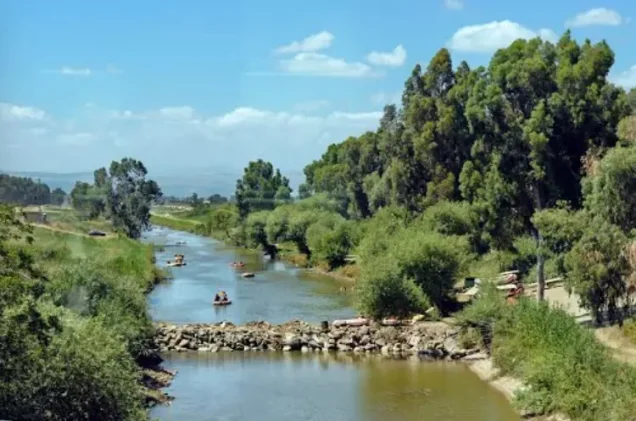
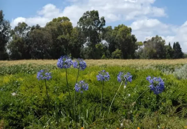
The village was completely demolished, leaving few readily identifiable traces of its buildings. The site was later converted into a fish-rearing facility containing a series of ponds. A narrow strip of thorny vegetation and trees remains between the ponds.
Sources
- PalQuest, “al-Mansura”.
- PalQuest, “Israeli Intelligence Report on the Depopulation of Palestine, 30 June 1948”.
- Palestine Remembered, “al-Mansura—Safad”.
- Walid Khalidi, ed., All That Remains: The Palestinian Villages Occupied and Depopulated by Israel in 1948, Institute for Palestine Studies, 1992.
- Government of Palestine, Census of Palestine, 1931.
- Government of Palestine, Village Statistics, April 1945.
- Benny Morris, The Birth of the Palestinian Refugee Problem, 1947–1949.
Photo gallery



Photos from the village's people
Photos sent in by visitors and published after review.
Add a photo of this village
Log in to add photos of this village.
Other villages from Safed


 Download Our Palestine App
The whole archive in the palm of your hand: depopulated villages, the Nakba, the massacres and Al-Aqsa — free, with no ads to erase the story.
Download Our Palestine App
The whole archive in the palm of your hand: depopulated villages, the Nakba, the massacres and Al-Aqsa — free, with no ads to erase the story.



Comments
No comments yet — be the first to write one.
Add your comment
Name and email are optional. Comments appear after review.